


October 2026 Trail News
Why would they build a trail there?

Creating trails after cities are established becomes a game of finding corridors where nothing else has been built. Utility (sewer and electric transmission lines) allow logical trail corridors.

Easements along roads help piece together trails. Even bike lanes, while not as family user friendly, can make trail connections work. One popular scenic trail corridor is along creeks and rivers in flood plains.
Jon Bogert, of Anderson-Bogert Engineering states, “…trails are one of the few infrastructure types permitted within floodplains because of their high flood tolerance. Unlike roads, buildings, or utility stations, a submerged trail does not cause catastrophic economic failure or immediate danger to human life, provided it is closed during high-water events. However, utilizing these zones means that occasional maintenance is an expected part of the trail lifecycle. After floodwaters recede, managing agencies must invest resources to clear deposited silt and debris, repair surface erosion, and fix structural damage to ensure the path is safe for public use again.”

Questions were raised concerning the Indian Creek bridges along the soon to open CeMar Trail. The bridges and approaches appear to the non-engineer eye to be set low. Bogert continues to explain “Recreational trail development in Iowa must strictly adhere to the Iowa Department of Natural Resources (DNR) Flood Plain Management regulations to ensure public safety and environmental protection. A critical constraint is the restriction on placing fill material within a designated floodway. The Iowa DNR generally prohibits any fill or construction that causes an increase in the water surface elevation of the 100-year flood. Because trails often require grading, embankments, or structural supports, engineers must carefully design these elements to ensure they do not create an obstruction to flood flows or violate state surcharge limits. Altering the floodway by raising ground elevations can have severe hydraulic consequences upstream. A floodway acts as the primary channel needed to discharge floodwaters downstream. When fill material raises the floodway elevation, it creates a bottleneck effect, restricting water flow and forcing water levels to rise. This artificial restriction can cause upstream backwater flooding, expanding the flood risk zone and potentially inundating homes, businesses, and agricultural land that were previously safe. Consequently, any proposed trail alignment that requires raising the floodway must undergo rigorous hydraulic modeling to prove it will not negatively impact upstream properties.
"Having lived along Indian Creek for 23 years- and close to the Sac and Fox Trail, I have personally noted the rise of downstream flooding as development occurred upstream. After the flood of 1993, changes were made to protect neighborhoods from flood waters and development upstream was reviewed. The Sac and Fox Trail remained in the floodplain and resilient. After each flood, crushed limestone was replaced or an alignment moved. Hikers and bicyclist were back out soon after. We need to remember repairing a trail is a lot easier than a house or business. Always happy we can use scenic floodplains for recreation!"
Diane Handler, LCTA Board Member, has promoted trails since the 1990's
American Discovery Trail Relay was a Great Success

The Linn County contingent of riders was the largest group since Denver Colorado! Linn County made a great show of support for the ADT portion on the Cedar Valley Nature Trail. Thanks to all the organizers and participants who were able to join and celebrate!
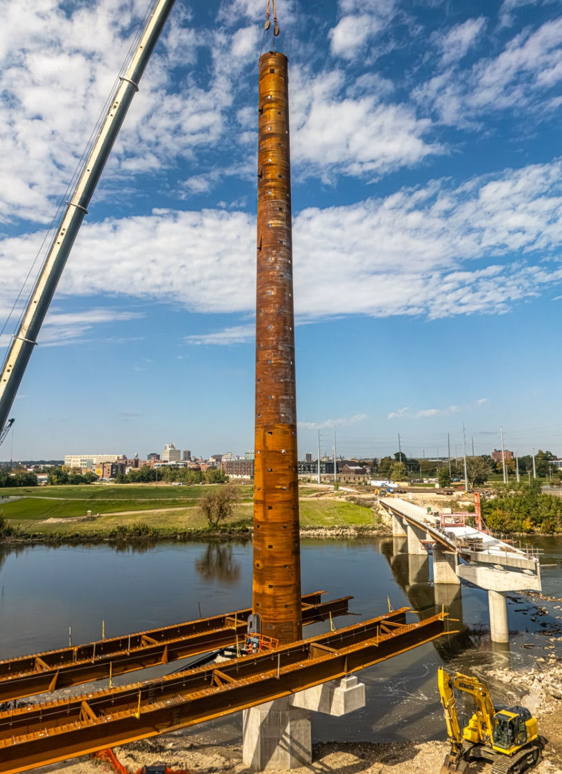
Alliant Energy LightLine Bridge is close to the finish line! The tower is in place, and the bridge sections are coming together. Completion should be by the end of the year with the opening spring 2027. This will be an exciting connection for pedestrians and bicyclists.
Egdewood Rd Trail from Glass Rd to 42nd St. construction contract has been awarded. Work could start in 2026 with completion in 2027.
CeMar Trail - The opening of this trail from Mt Calvary to Marion was delayed due to flood waters in September. The section under HWY 100 was under construction and affected. We are still hopeful that the Grand Opening will be late October or early November.
Business Sponsors 2026 to date

Calendar
Newbie Tuesday Bike Rides sponsored by LAMBA check out weekly updates https://www.facebook.com/groups/lambatrails/
LCTA Board meetings second Monday of the month – visit our website for more information


